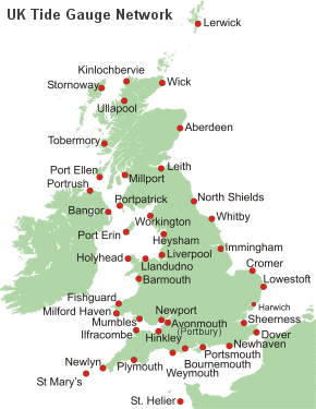
High and low water times and heights at St. Helier
Tidal predictions are available for the next 28 days. For information beyond this period, please consider using the POLTIPS·3 software package, available for purchase from the Marine Data Products Team.
Times in GMT, heights in metres above chart datum. For times in BST, add one hour.
Predictions DO NOT include meteorological effects.
(H - high water, L - low water)
© National Oceanography Centre, Liverpool
Thu 9th
May 202401:23
1.01m L07:03
11.23m H13:42
1.10m L19:19
11.20m H
May 202401:23
1.01m L07:03
11.23m H13:42
1.10m L19:19
11.20m H
Fri 10th02:04
1.15m L07:44
10.94m H14:21
1.44m L19:57
10.89m H
1.15m L07:44
10.94m H14:21
1.44m L19:57
10.89m H
Sat 11th02:43
1.53m L08:23
10.41m H14:58
1.98m L20:34
10.36m H
1.53m L08:23
10.41m H14:58
1.98m L20:34
10.36m H
Sun 12th03:21
2.11m L09:02
9.71m H15:33
2.66m L21:11
9.68m H
2.11m L09:02
9.71m H15:33
2.66m L21:11
9.68m H
Mon 13th03:57
2.80m L09:42
8.94m H16:09
3.38m L21:50
8.95m H
2.80m L09:42
8.94m H16:09
3.38m L21:50
8.95m H
Tue 14th04:38
3.49m L10:28
8.24m H16:53
4.01m L22:39
8.29m H
3.49m L10:28
8.24m H16:53
4.01m L22:39
8.29m H
Wed 15th05:30
4.03m L11:30
7.74m H17:52
4.45m L23:50
7.84m H
4.03m L11:30
7.74m H17:52
4.45m L23:50
7.84m H
Thu 16th06:40
4.30m L12:52
7.60m H19:12
4.55m L
4.30m L12:52
7.60m H19:12
4.55m L
Fri 17th01:16
7.79m H08:00
4.19m L14:09
7.86m H20:31
4.26m L
7.79m H08:00
4.19m L14:09
7.86m H20:31
4.26m L
Sat 18th02:28
8.11m H09:08
3.81m L15:08
8.33m H21:33
3.78m L
8.11m H09:08
3.81m L15:08
8.33m H21:33
3.78m L
Sun 19th03:24
8.56m H10:00
3.36m L15:55
8.83m H22:22
3.27m L
8.56m H10:00
3.36m L15:55
8.83m H22:22
3.27m L
Mon 20th04:09
9.02m H10:45
2.93m L16:36
9.30m H23:06
2.81m L
9.02m H10:45
2.93m L16:36
9.30m H23:06
2.81m L
Tue 21st04:50
9.43m H11:27
2.56m L17:13
9.69m H23:47
2.43m L
9.43m H11:27
2.56m L17:13
9.69m H23:47
2.43m L
Wed 22nd05:27
9.77m H12:07
2.28m L17:48
10.02m H
9.77m H12:07
2.28m L17:48
10.02m H
Thu 23rd00:26
2.13m L06:03
10.02m H12:45
2.10m L18:23
10.25m H
2.13m L06:03
10.02m H12:45
2.10m L18:23
10.25m H
Fri 24th01:04
1.95m L06:40
10.17m H13:21
2.03m L18:57
10.38m H
1.95m L06:40
10.17m H13:21
2.03m L18:57
10.38m H
Sat 25th01:41
1.88m L07:17
10.19m H13:57
2.08m L19:33
10.37m H
1.88m L07:17
10.19m H13:57
2.08m L19:33
10.37m H
Sun 26th02:18
1.94m L07:54
10.07m H14:32
2.24m L20:10
10.22m H
1.94m L07:54
10.07m H14:32
2.24m L20:10
10.22m H
Mon 27th02:55
2.11m L08:36
9.82m H15:09
2.50m L20:51
9.92m H
2.11m L08:36
9.82m H15:09
2.50m L20:51
9.92m H
Tue 28th03:36
2.37m L09:21
9.46m H15:52
2.83m L21:39
9.54m H
2.37m L09:21
9.46m H15:52
2.83m L21:39
9.54m H
Wed 29th04:24
2.69m L10:13
9.07m H16:44
3.18m L22:36
9.16m H
2.69m L10:13
9.07m H16:44
3.18m L22:36
9.16m H
Thu 30th05:21
2.96m L11:15
8.77m H17:47
3.42m L23:44
8.92m H
2.96m L11:15
8.77m H17:47
3.42m L23:44
8.92m H
Fri 31st06:28
3.09m L12:27
8.67m H18:59
3.44m L
3.09m L12:27
8.67m H18:59
3.44m L
Sat 1st
Jun 202400:59
8.93m H07:39
2.99m L13:39
8.85m H20:12
3.21m L
Jun 202400:59
8.93m H07:39
2.99m L13:39
8.85m H20:12
3.21m L
Sun 2nd02:10
9.18m H08:49
2.71m L14:47
9.22m H21:21
2.81m L
9.18m H08:49
2.71m L14:47
9.22m H21:21
2.81m L
Mon 3rd03:15
9.57m H09:53
2.38m L15:48
9.68m H22:23
2.39m L
9.57m H09:53
2.38m L15:48
9.68m H22:23
2.39m L
Tue 4th04:14
9.95m H10:51
2.08m L16:41
10.10m H23:21
2.05m L
9.95m H10:51
2.08m L16:41
10.10m H23:21
2.05m L
Wed 5th05:08
10.25m H11:45
1.89m L17:30
10.42m H
10.25m H11:45
1.89m L17:30
10.42m H
Disclaimer
While every effort has been made to ensure the accuracy of the information provided, no responsibility can be accepted by the National Oceanography Centre for any consequential loss or damage arising from its use.